This page was last updated on 3rd April 2004.
| name | Trojaburg or Schwedenhieb | |
| medium | turf and gravel | |
| dimensions | overall diameter | 30' |
| diameter of centre | 16" | |
| average path width | 10" | |
| average inter-path gap | 9" | |
| location | at the edge of the village, on the south side of the road to Grabsdorf, on a mound | |
| orientation | S | |
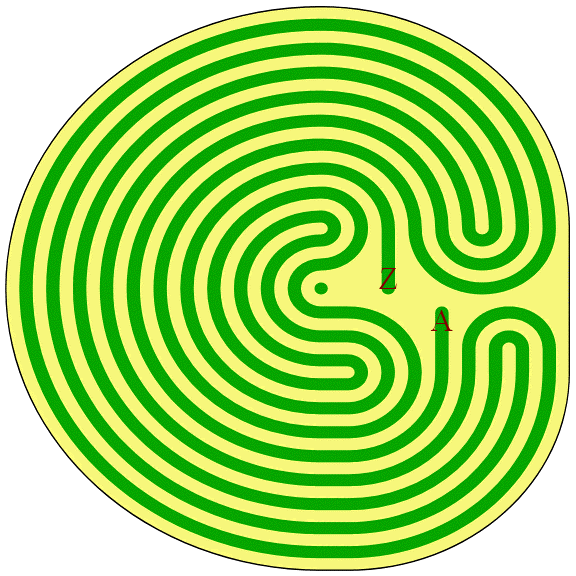
| layout |
clockwise;
11(1);
O3,2I,O3,2I5,O3,2I,O3;
circular.
The first and last sections of the path are missing (the straight radial sections from the entrance and to the centre). For analysis purposes I assume that the path starts at "A" and ends at "Z" rather than vice versa. Thus the layout conforms with that of Steigra. | |
| visit | 2004 | |
| information on site |
Protected Site "Troy town", also Swedish Cutting Has its origin in sun worship of nordic bronze age. Laid out in Thirty Years' War by Swedish soldiers? Hill resulting from gravel workings Thuringian Land Ministry for the Care of Archeological Monuments Weimar | |
Note that there are two Graitschens, fairly close to each other. You want the one near Schk÷len, not the one near B³rgel.
Back to maze list